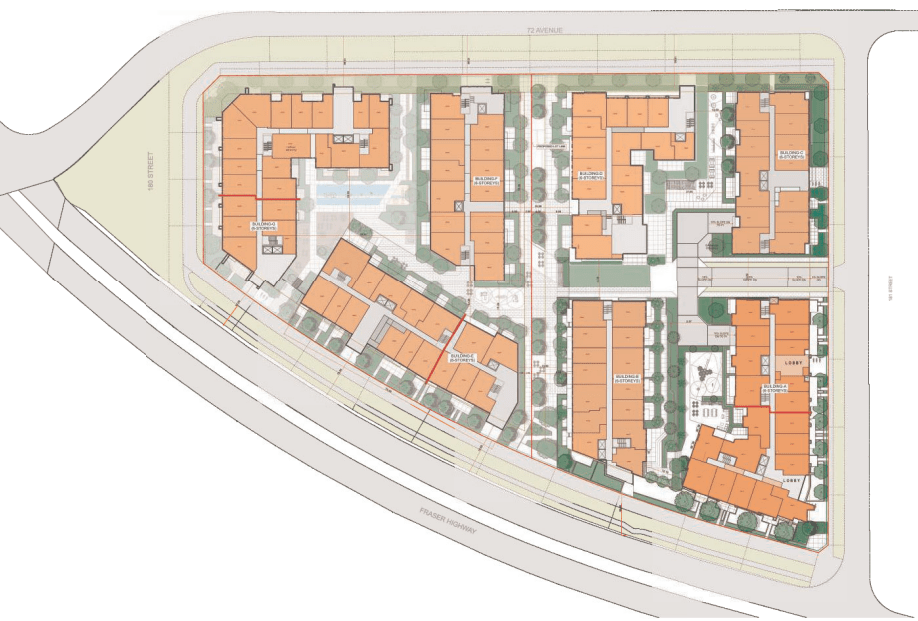
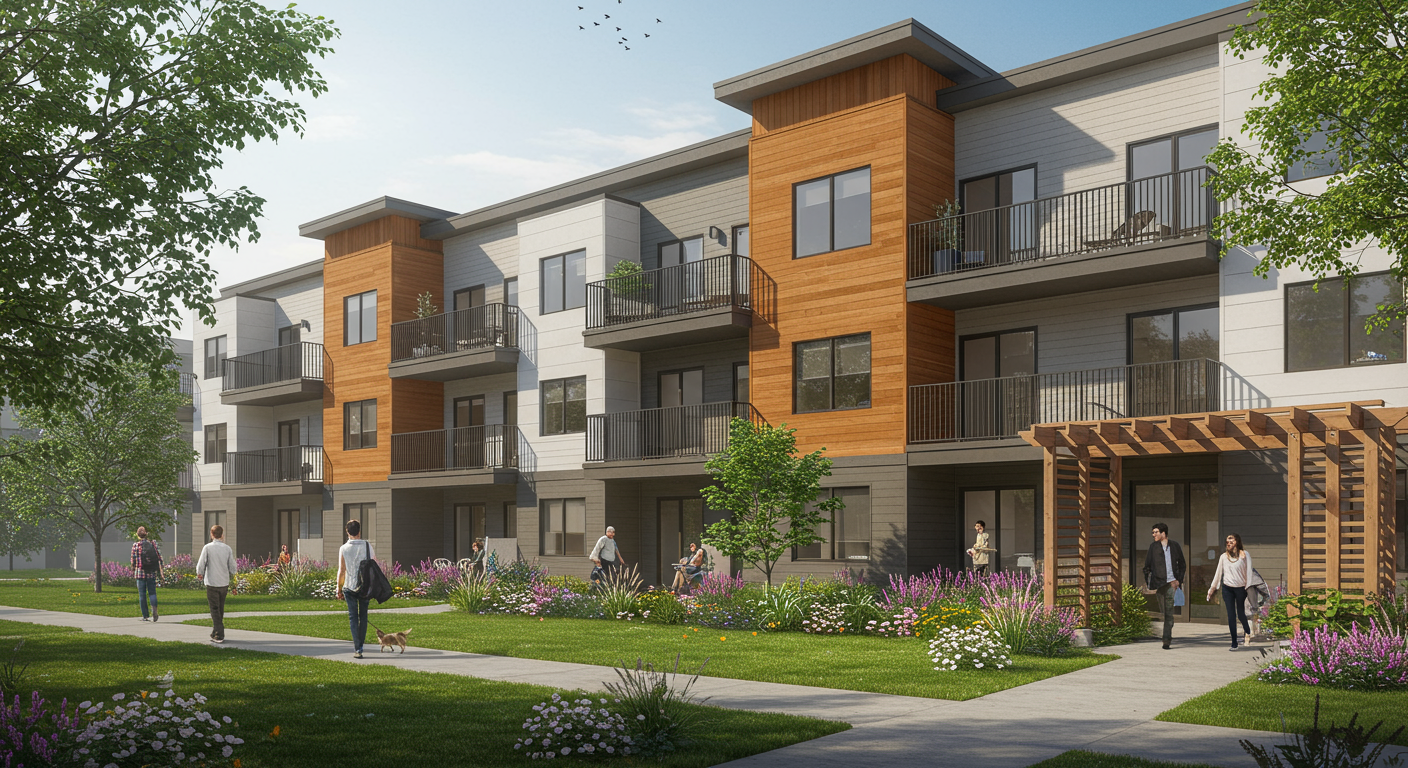
South Surrey-based Zenterra Developments has submitted a development application for its nearly 6-acre land assembly in Surrey's upcoming West Clayton neighbourhood: Seven 6-storey buildings, totaling 713 homes.
The development is being guided by the recently approved Transit-Oriented Area guidelines, which set minimum densities for sites located within certain distances of SkyTrain and rapid transit. Originally zoned for townhome use, Zenterra's location falls under the "Tier 3" category of the TOA guidelines, which allow for a gross density up to 3.0 FSR and building heights of up to 8-storeys.
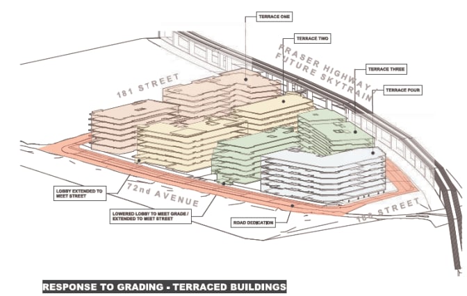
The seven 6-storey buildings will comprise a total of 713 condos located adjacent to Fraser Highway.
Unit Mix
- Studios: 70 (9.8%)
- 1-Bedroom: 354 (50%)
- 2-Bedroom: 289 (41%)
- 3-Bedroom: * (%)
- Total: 713
*Planning has indicated that developer will work with staff to include more 3-bedroom homes before final adoption.
A total of 557,850 residential square feet is planned for this site. This equates to an estimated average unit size of 650 square feet.
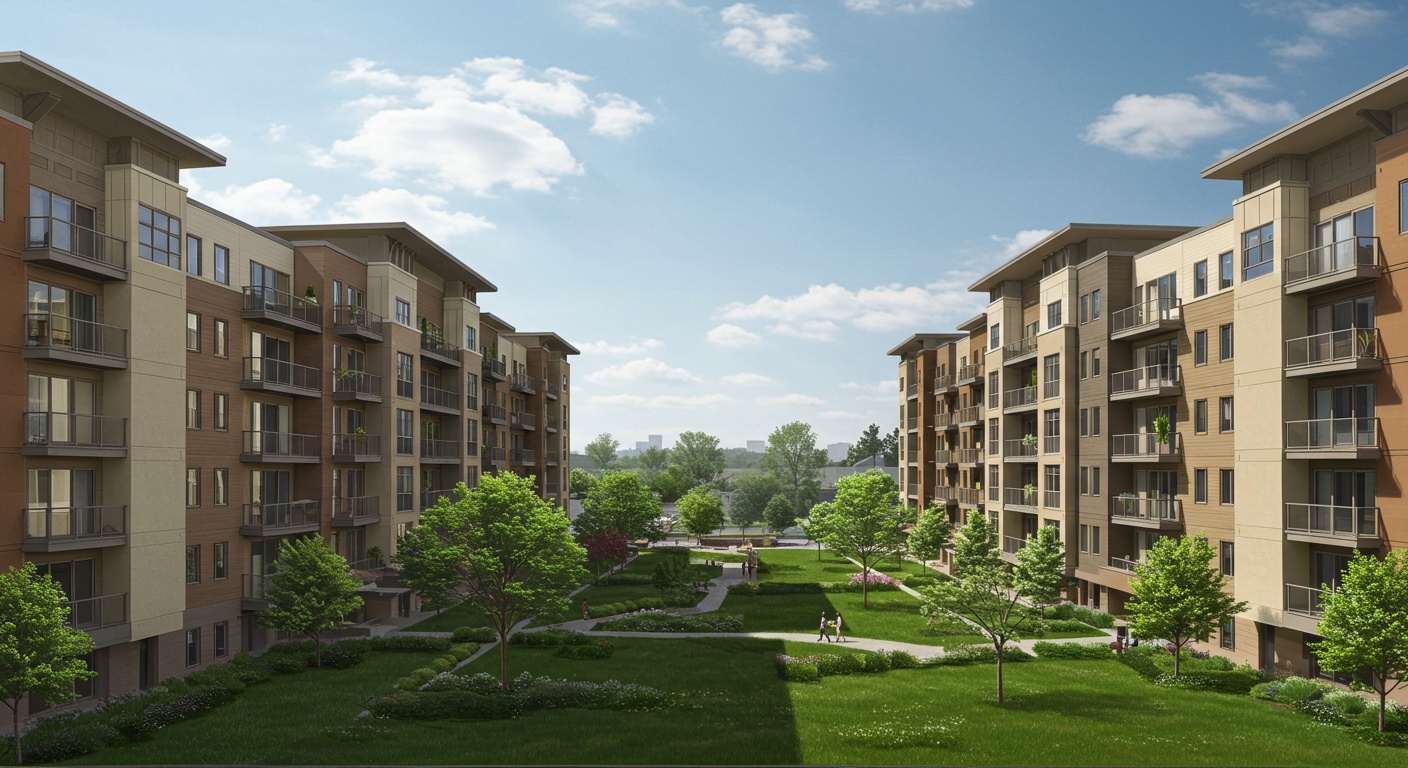
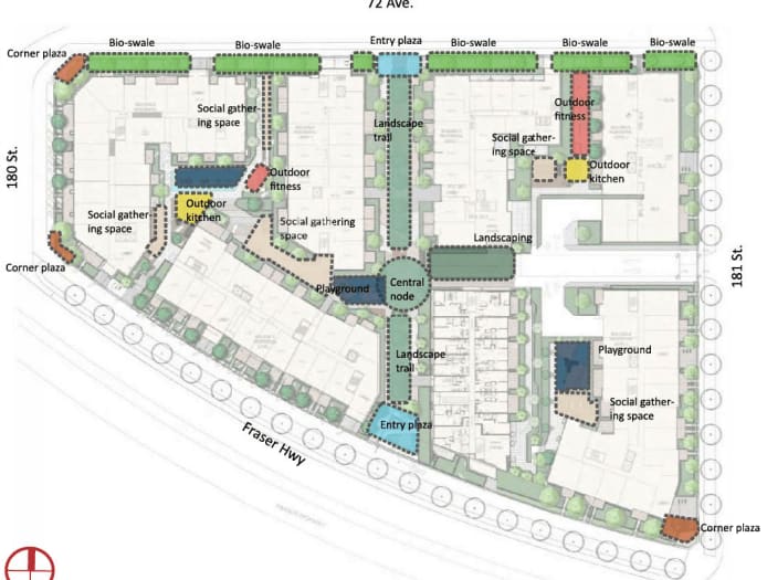
"The proposed ground level outdoor amenity is organized into three general areas, an east courtyard, west courtyard, and the pedestrian mews. The east and west courtyard areas include social gathering space, outdoor kitchens, outdoor fitness space, lawns and playgrounds. The pedestrian mews includes a landscaped trail with entry and central plaza nodes."

According to the planning document, Zenterra anticipates phase 1 of the development to be constructed and ready for occupancy by early 2027 -- this can however change depending on application approval process.
Planning application: www.surrey.ca/sites/default/files/planning-reports/PLR_7923-0255-00.pdf
West Clayton NCP Map:
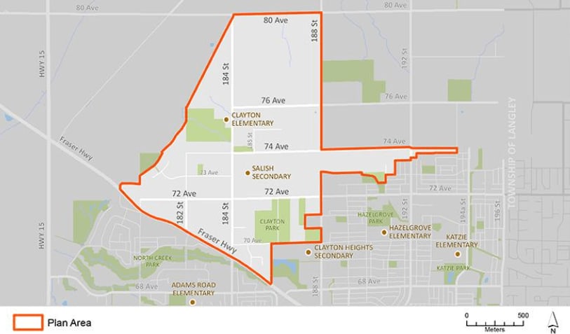
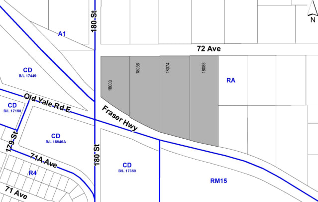
The West Clayton neighbourhood plan was first introduced in July 2010, marking nearly 14 years of review and process. It is located just east of the 176th (Highway 17) and Fraser Highway corridor, adjacent to the nearly built-out East Clayton neighbourhood, which borders the Township of Langley.
The neighbourhood encompasses 713 acres of land, largely comprised of older acreage properties. Over the time of planning, much has changed in the overall landscape of Metro Vancouver.
The neighbourhood spans 713 acres, mostly consisting of older acreage properties. During the planning period, the landscape of Metro Vancouver has evolved significantly. Initially envisioned as a low-density neighbourhood with small-lot single-family homes, townhomes/rowhomes, and low-rise apartments, the area has undergone substantial changes in recent years. The introduction of the Surrey-Langley Skytrain has shifted the focus towards creating a transit-oriented community.
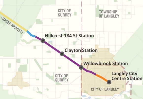
The Surrey Langley Skytrain project will extend the Expo Line 16 kilometers, connecting King George Station in Surrey City Centre to the City of Langley. As such, government authorities have created policy to ensure substantial density along this corridor.
While the West Clayton neighbourhood plan was receiving final approval and infrastructure upgrades for sanitary, water, and sewer systems were about to commence, new neighbourhood plans were introduced to guide future development along these transit-oriented areas (TOA).
West Clayton Neighbourhood Plan: www.surrey.ca/renovating-building-development/land-planning-development/land-use-planning/cloverdale-land-use-plans/west-clayton-ncp
Clayton Corridor Map:
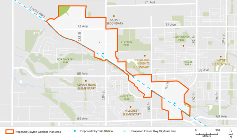
The Clayton Corridor plan includes two future SkyTrain stations: Hillcrest-184 Street Station and Clayton Station (190th Street).
The provincial government has updated policies regarding these Transit-Oriented Areas, setting minimum density requirements along the transit corridors. Depending on the distance to the SkyTrain, minimum densities have been predetermined that supersede any municipal neighbourhood plans.
Clayton Corridor Plan: www.surrey.ca/renovating-building-development/land-planning-development/land-use-planning/cloverdale-land-use-plans/clayton-corridor-plan